Landmarks and Historical Sites
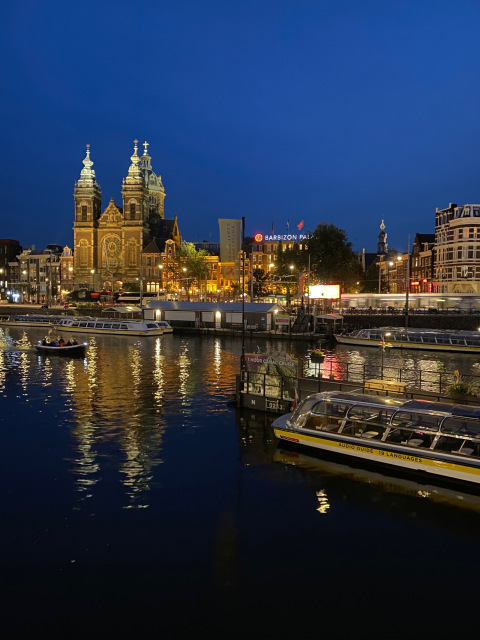
Landmarks, historic sites, and tourist attractions tell stories that are best told from above. The relationship between a structure and its surroundings, the scale of a site within its landscape, the visual context that makes a place meaningful — these are things that ground-level photography simply cannot communicate. Aerial and elevated photography gives tourism boards, attraction operators, and historic preservation organizations the imagery that makes people want to visit.
NE Ohio Drone brings FAA Part 107 licensing, professional equipment, and a genuine understanding of composition and visual storytelling to landmark and heritage photography. Ed Rich has shot landmark sites both locally and internationally — and brings that perspective to every project in Northeast Ohio and beyond.
Clearview Golf Club, East Canton, Ohio — America's first golf course designed, built, and owned by an African American, William Powell, and listed on the National Register of Historic Places. NE Ohio Drone was commissioned to produce both aerial stills and video of Clearview — capturing the layout, character, and historic significance of the course from above in a way that does justice to its place in American history. Clearview represents exactly the kind of project where professional aerial photography adds genuine cultural and documentary value, not just marketing imagery.
Who This Service Is For
Convention and visitors bureaus need aerial imagery that makes Northeast Ohio's attractions look as compelling as they are. Professional aerial video and stills for destination marketing campaigns, websites, and social media give potential visitors a reason to choose this region over anywhere else.
Aerial photography creates a comprehensive visual record of historic properties and sites — documenting structures, grounds, and context that future generations may never see in their current condition. Licensed operators understand the sensitivity required around irreplaceable heritage sites.
From the Cuyahoga Valley to Mill Creek Park to the Lake Erie shoreline, Northeast Ohio's natural landmarks are world-class subjects for aerial photography. Park systems, conservancies, and nature centers use aerial imagery for trail maps, fundraising materials, grant applications, and public engagement campaigns.
Arenas, amphitheaters, cultural institutions, and major attractions all benefit from aerial photography that shows scale, location, and the full visitor experience. Aerial video is increasingly the standard for venue marketing and event promotion across Northeast Ohio.
Broadcast-quality aerial footage for documentary films, news features, and editorial projects covering Northeast Ohio's history, culture, and geography. Ed Rich's marketing and storytelling background means the footage is shot with the final narrative in mind, not just technically competent imagery handed off for someone else to figure out.
Cities, counties, and economic development agencies use aerial photography to showcase infrastructure, development corridors, and community assets to prospective businesses and residents. Aerial imagery of Akron, Cleveland, Canton, and Youngstown tells a growth story that ground-level photography cannot.
Ed Rich is actively building relationships with tourism organizations, historic preservation groups, and landmark properties across Northeast Ohio. If you manage a site or attraction and have wondered what professional aerial photography could do for your marketing or documentation program, the conversation starts with a phone call or email — no obligation, no pressure.
Tourism boards, historic sites, parks, and attractions across Northeast Ohio — Ed Rich would love to show you what's possible.